
Pangasinan (Pangasinan: Luyag na Panggasinan; Filipino: Lalawigan ng Pangasinan) is a province in the Philippines. Its provincial capital is Lingayen. Pangasinan is on the western area of the island of Luzon along the Lingayen Gulf and West Philippine Sea. It has a total land area of 5,451.01 square kilometres (2,104.65 sq mi). According to the 2015 census, it has a population of 2,956,726 people. The official number of registered voters in Pangasinan is 1,651,814. The western portion of the province is part of the homeland of the Sambal people, while the central and eastern portions are the homeland of the Pangasinan people. Due to ethnic migration, Ilocano people have settled in some areas of the province.
Pangasinan is the name for the province, the people, and the language spoken in the province. Indigenous Pangasinan speakers are estimated to number at least 2 million. The Pangasinan language, which is official in the province, is one of the officially recognized regional languages in the Philippines. In Pangasinan, there were several ethnic groups who enriched the cultural fabric of the province. Almost all of the people are Pangasinans and the rest are descendants of Bolinao and Ilocano, who settled the eastern and western parts of the province. Pangasinan is spoken as a second-language by many of the ethnic minorities in Pangasinan. The secondary ethnic groups are the Bolinaos (who are essentially Sambal people) and the Ilocanos.
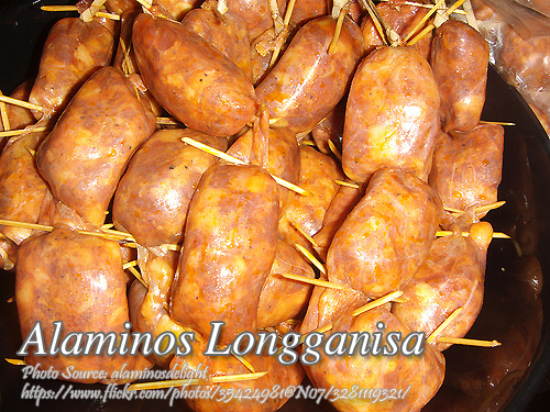
The name Pangasinan (pronounced "Pang-ASINan") means "place of salt" or "place of salt-making"; it is derived from the prefix pang, meaning "for", the root word asin, meaning "salt", and suffix an, signifying "location". At present it is pronounced "Paŋgasinan" based on the Spanish pronunciation. The province is a major producer of salt in the Philippines. Its major products include bagoong ("salted-krill") and alamang ("shrimp-paste").
Pangasinan was first founded by Austronesian peoples who called themselves Anakbanwa by at least 2500 BC. A kingdom called Luyag na Caboloan, which expanded to incorporate much of northwestern Luzon, existed in Pangasinan before the Spanish conquest that began in the 16th century.[6] The Kingdom of Luyag na Kaboloan was known as the Wangdom of Pangasinan in Chinese records. The ancient Pangasinan people were skilled navigators and the maritime trade network that once flourished in ancient Luzon connected Pangasinan with other peoples of Southeast Asia, India, China, Japan and the rest of the Pacific. The ancient kingdom of Luyag na Caboloan was in fact mentioned in Chinese and Indian records as being an important kingdom on ancient trade routes.
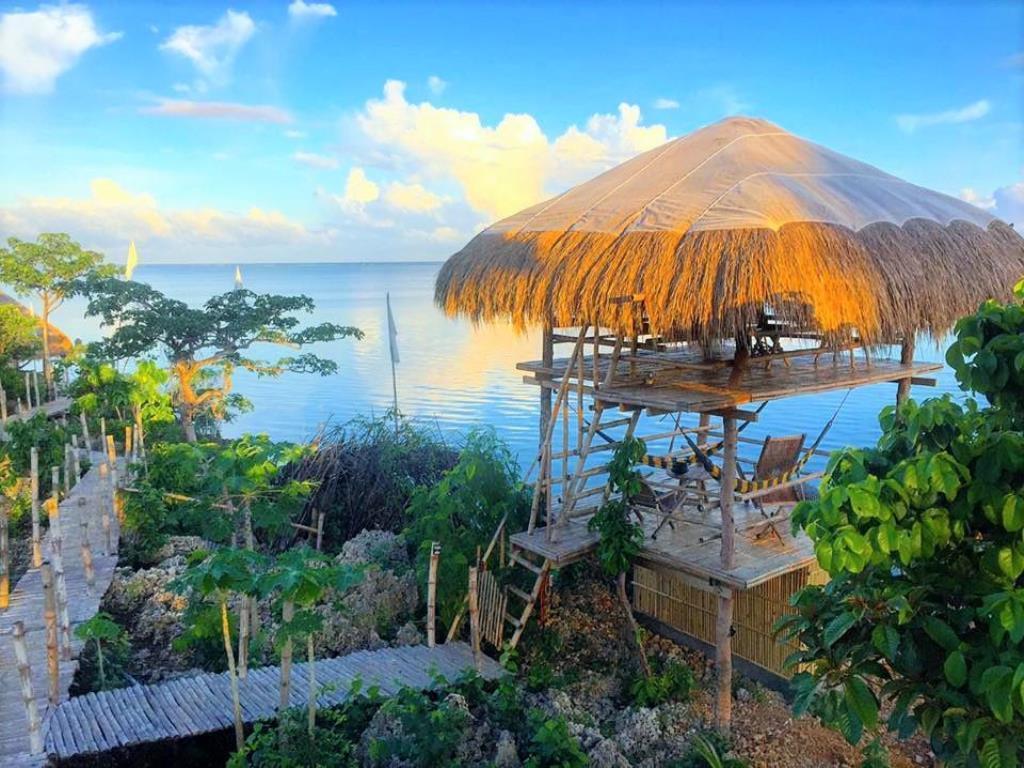
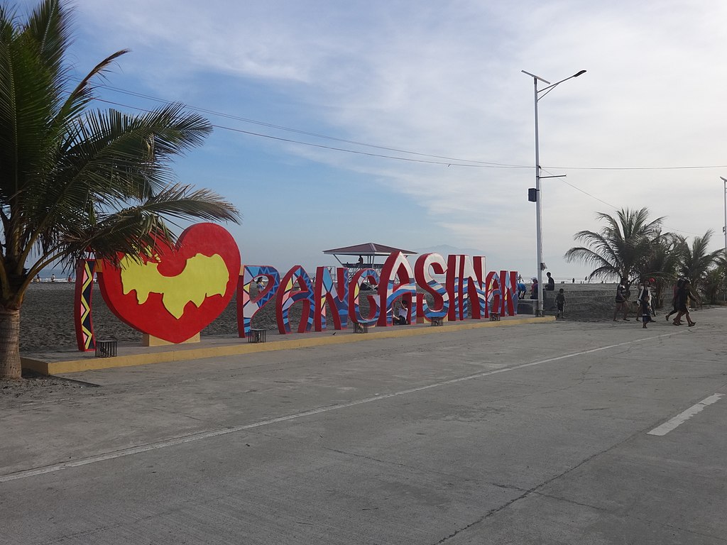
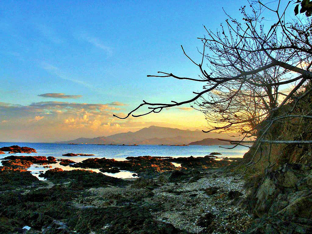
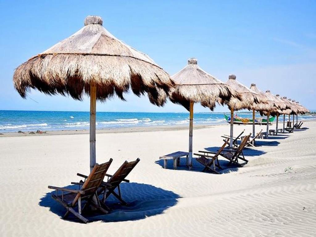
Popular tourist attractions in Pangasinan include the Hundred Islands National Park in Alaminos City and the white-sand beaches of Bolinao and Dasol. Dagupan City is known for its Bangus Festival ("Milkfish Festival"). Pangasinan is also known for its delicious mangoes and ceramic oven-baked Calasiao puto ("native rice cake"). Pangasinan occupies a strategic geo-political position in the central plain of Luzon. Pangasinan has been described as a gateway to northern Luzon.A vast maritime trade network connected the distant Austronesian settlements in Southeast Asia, the Pacific and the Indian Ocean. The Pangasinan people were part of this ancient Austronesian civilization.
The ancient Austronesian-speakers were expert navigators. Their outrigger canoes and sailboats were capable of crossing the distant seas. The Malagasy sailed from the Malay archipelago to Madagascar, an island across the Indian Ocean, and probably reached Africa. As the possible predecessors of the Polynesians, large seagoing canoes called "bangka" ("vaka" in several Polynesian dialects and "waka" in Maori) were first developed by Austronesians in the Philippine archipelago which were then used to settle and establish long-distance trade networks with distant Pacific islands from the Micronesian island nations of Guam and Palau as far away as Hawaii and Easter Island and probably reached the Pacific coastline of the Americas. Proof of these trade exchanges are the prevalence of "kumara" or sweet potato in the Pacific Islands which is endemic to South America, and the abundance of chicken bones in ancient South American archaeological dig sites whose closest genetic relatives are those of chickens from Asia. At least three hundred years before the arrival of Europeans, the Makasar and the Bugis from Sulawesi, in what is now Indonesia, as well as the Sama-Bajaus of the Malay Archipelago, carried out long-distance commerce with their prau or paraw ("sailboat") and established settlements in north Australia, which they called Marege.
Pangasinan was founded by Austronesian peoples who called themselves Anakbanwa during the Austronesian expansion from Taiwan and Southern China in about 5000–2500 BC or the Austronesian dispersal from Sundaland at least 7,000 years ago after the last Ice Age. Anakbanwa means “child of banwa.” Banwa (also spelled banua or vanua) is an Austronesian concept that could mean territory, homeland, habitat, society, civilization or cosmos. The Pangasinan people identified or associated banwa with the sun, which was their symbol for their banwa. The Pangasinan people are closely related to the Ibaloi in the neighboring province of Benguet and other peoples of Luzon. The Anakbanwa established their settlements in the banks of the Agno River and the coasts of Lingayen Gulf. The coastal area came to be known as Pangasinan, and the interior area came to be known as Kaboloan. Eventually, the whole region, its people and the used language came to be known as Pangasinan. Archaeological evidence and early Chinese and Indian records show that the inhabitants of Pangasinan traded with India, Arabia, China and Japan as early as the 8th century A.D.In the sixteenth-century Pangasinan was called the "Port of Japan" by the Spanish. The locals wore native apparel typical of other maritime Southeast Asian ethnic groups in addition to Japanese and Chinese silks. Even common people were clad in Chinese and Japanese cotton garments. They blackened their teeth and were disgusted by the white teeth of foreigners, which were likened to that of animals. They used porcelain jars typical of Japanese and Chinese households. Japanese-style gunpowder weapons were encountered in naval battles in the area.[13] In exchange for these goods, traders from all over Asia would come to trade primarily for gold and slaves, but also for deerskins, civet and other local products. Other than a notably more extensive trade network with Japan and China, they were culturally similar to other Luzon groups to the south.
Pangasinans were also described as a warlike people who were long known for their resistance to Spanish conquest. Bishop Domingo Salazar described them as really the worst people, the fiercest and cruelest in the land. There was evidence of Christian influence even before Spanish colonization; they used vintage wine in small quantities for their sacramental practices. The church bragged that they won the northern part of the Philippines for Spain not Spanish military. They were unusually strict against adulterers, with the punishment being death for both parties. Pangasinans were known to take defeated Zambal (Aeta) and Negrito warriors to sell as slaves to Chinese traders.In 1571, the Spanish conquest of Pangasinan began with an expedition by the Spanish conquistador Martín de Goiti, who came from the Spanish settlement in Manila through Pampanga. About a year later, another Spanish conquistador, Juan de Salcedo, sailed to Lingayen Gulf and landed at the mouth of the Agno River. Limahong, a Chinese pirate, fled to Pangasinan after his fleet was driven away from Manila in 1574. Limahong failed to establish a colony in Pangasinan, as an army led by Juan de Salcedo chased him out of Pangasinan after a seven-month siege.
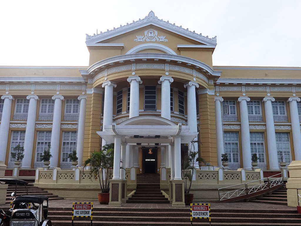
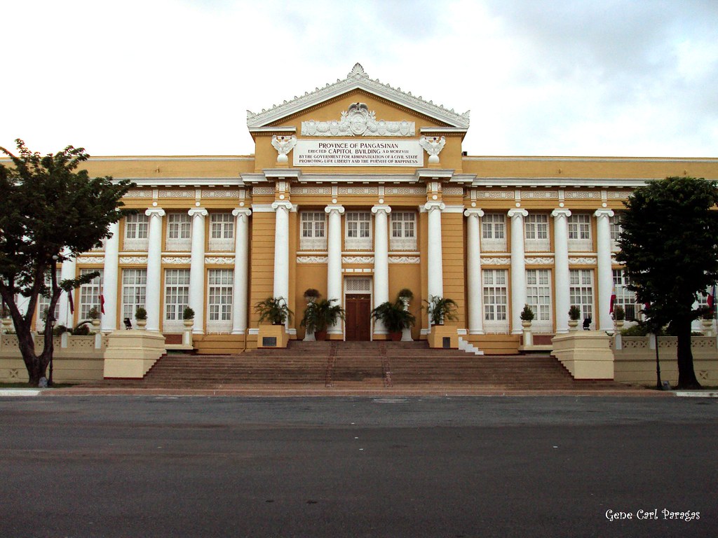
The province of Pangasinan dates its actual beginnings as an administrative and judicial district, with Lingayen as the capital, to as early as 1580, but its territorial boundaries were first delineated in 1611. Lingayen has remained the capital of the province except for a brief period during the revolutionary Era when San Carlos served as temporary administrative headquarters, and during the slightly longer Japanese Occupation when Dagupan was the capital.
The province of Pangasinan was formerly classified as an alcaldia mayor de termino, or first class civil province, during the Spanish regime and has, in fact, remained a first class-A province up to the present. Its territorial jurisdiction once included the entire province of Zambales and portions of what are now Tarlac and La Union provinces.The Katipunan, a nationalist secret society, was founded on July 7, 1892 with the aim of uniting the peoples of the Philippines and fighting for independence and religious freedom. The Philippine Revolution began on August 26, 1896 and was led by Andres Bonifacio, the leader of the Katipunan. On November 18, 1897, a Katipunan council was formed in western Pangasinan with Roman Manalang as Presidente Generalisimo and Mauro Ortiz as General. General Emilio Aguinaldo proclaimed Philippine independence on June 12, 1898. Dagupan City, the major commercial center of Pangasinan, was surrounded by Katipunan forces by July 18, 1898. The Battle of Dagupan lasted from July 18 to July 23 of that year with the surrender of 1,500 soldiers of the Spanish forces under Commander Federico J. Ceballos and Governor Joaquin de Orengochea.
The Battle of Dagupan, fought fiercely by local Katipuneros under the overall command of General Francisco Makabulos, chief of the Central and Directive Committee of Central and Northern Luzon, and the last remnants of the once mighty Spanish Army under General Francisco Ceballos, led to the liberation of Pangasinan from the Spaniards. The five-day battle was joined by three local heroes: Don Daniel Maramba from Santa Barbara, Don Vicente Prado from San Jacinto and Don Juan Quezada from Dagupan. Their armies massed in Dagupan to lay siege on the Spanish forces, making a last stand at the brick-walled Catholic Church.
Maramba led the liberation of the town of Santa Barbara on March 7, 1898 following a signal for simultaneous attack from Makabulos. Hearing that Santa Barbara fell into rebel hands, the Spanish forces in Dagupan attempted to retake the town, but were repulsed by Maramba's forces. Thus, after the setback, the Spaniards decided to concentrate their forces in Lingayen to protect the provincial capital. This enabled Maramba to expand his operations to Malasiqui, Urdaneta and Mapandan, taking them one after the other. He took one more town, Mangaldan, before proceeding to Dagupan to lay siege on the last Spanish garrison. Also on March 7, 1898, the rebels under the command of Prado and Quesada attacked convents in a number of towns in Zambales province, located west of Lingayen, which now constitute the western parts of Pangasinan.
Attacked and brought under Filipino control were Alaminos, Agno, Anda, Alos, Bani, Balincaguin, Bolinao, Dasol, Eguia and Potot. The revolt then spread to Labrador, Sual, Salasa and many other towns in the west. The towns of Sual, Labrador, Lingayen, Salasa and Bayambang were occupied first by the forces of Prado and Quesada before they proceeded to attack Dagupan.
At an assembly convened to organize a central governing body for Central and Northern Luzon on April 17, 1898, General Makabulos appointed Prado as politico-military governor of Pangasinan, with Quesada as his second in command. His appointment came a few days before the return of General Emilio Aguinaldo in May 1898 from his exile in Hong Kong following the signing of the Pact of Biac-na-Bato in December 1897. Aguinaldo's return gave fresh impetus to the renewal of the flame of the revolution. Thus, on June 3, 1898, General Makabulos entered Tarlac and from that day on, the fires of revolution spread.
So successful were the Filipinos in their many pitched battles against the Spaniards that on June 30, 1898, Spanish authorities decided to evacuate all their forces to Dagupan where a last stand against the rebels was to be made. They were ordered to go to Dagupan were all civilian and military personnel, including members of the volunteer locales of towns not yet in rebel hands. Those who heeded this order were the volunteer forces of Mangaldan, San Jacinto, Pozorrubio, Manaoag, and Villasis. Among the items brought to Dagupan was the image of the Most Holy Rosary of the Virgin of Manaoag, which was already the patron saint of Pangasinan.
When the forces of Maramba from the east and Prado from the west converged in Dagupan on July 18, 1898, the siege began. The arrival of General Makabulos strengthened the rebel forces until the Spaniards, holed up inside the Catholic Church, waved the flag of surrender five days later. Armed poorly, the Filipinos were no match at the very start with Spanish soldiers holed inside the Church. They just became mere sitting ducks to Spanish soldiers shooting with their rifles from a distance. But the tempo of battle changed when the attackers, under Don Vicente Prado, devised a crude means of protection to shield them from Spanish fire while advancing. This happened when they rolled trunks of bananas, bundled up in sawali, that enabled them to inch their way to the Church.Pangasinan and other parts of the Spanish East Indies were ceded to the Americans after the Treaty of Paris that closed the Spanish–American War. During the Philippine–American War, Lieutenant Col. Jose Torres Bugallon from the town of Salasa fought together with Gen. Antonio Luna to defend the First Philippine Republic against American colonization of Northern Luzon. Bugallon was killed in battle on February 5, 1899. The First Philippine Republic was abolished in 1901. In 1907, the Philippine Assembly was established and for the first time, five residents of Pangasinan were elected as its district representatives. In 1921, Mauro Navarro, representing Pangasinan in the Philippine Assembly, sponsored a law to rename the town of Salasa to Bugallon in order to honor General Bugallon.
During the Philippine Commonwealth regime, Manuel L. Quezon was inaugurated as the first president of the Commonwealth of the Philippines under the collaboration from the United States of America on November 15, 1935.
The 21st Infantry Division, Philippine Commonwealth Army, USAFFE was found military establishment and built of the general headquarters was active on July 26, 1941 to June 30, 1946 and they stationed in Pangasinan during the pre-World War II era. From the conflict engagements of the Anti-Japanese Imperial military operations included the fall of Bataan and Corregidor and aiding the USAFFE ground force from January to May 1942 and the Japanese Insurgencies and Allied Liberation in Pangasinan from 1942 to 1945 and some parts in North-Central Luzon and helps local guerrillas and American forces against the Japanese.After the declaration of Independence in Manila on July 4, 1946, Eugenio Perez, a Liberal Party congressman representing the fourth district of Pangasinan, was elected Speaker of the lower Legislative House. He led the House until 1953, when the Nacionalista Party became the dominant party.
Pangasinan, which is historically and geographically part of the Central Luzon Region, is made politically part of the Ilocos Region (Region I) in the gerrymandering of the Philippines by Ferdinand Marcos, despite the fact that Pangasinan has its distinct primary language, which is Pangasinan. The political classification of Pangasinan as part of the Ilocos Region has generated confusion among some Filipinos that the residents of Pangasinan are Ilocanos, even though Ilocanos only constitute a significant minority in the province. Pangasinan has a distinct primary language, ethnic group and culture, its economy is bigger than the predominantly Ilocano provinces of Ilocos Norte, Ilocos Sur and La Union and its population is more than 50 percent of the population of Region 1. Many Pangasinans prefer to have their province returned to Central Luzon.In February 1986, Vice Chief of Staff General Fidel V. Ramos, head of the Philippine Integrated National Police and a native of Lingayen, Pangasinan, became one of the instrumental figures of the EDSA people power revolution that led to the overthrow of President Ferdinand Marcos.
After the downfall of Marcos, all local government unit executives in the Philippines were ordered by President Corazon Aquino to vacate their posts. Some local executives were ordered to return to their seats as in the case of Mayor Ludovico Espinosa of Dasol, where he claims he joined the UNIDO, Mrs. Aquino's party during the height of the EDSA Revolution. Fidel Ramos was appointed as AFP Chief of Staff and later as Defense Secretary replacing Juan Ponce Enrile. Oscar Orbos, a congressman from Bani, Pangasinan, was appointed by Aquino as head of the Department of Transportation and Communications and later as Executive Secretary.
On May 11, 1992, Fidel V. Ramos ran for the position of President. He was elected and became the first Pangasinan President of the Philippines. Through his leadership, the Philippines recovered from a severe economy after the oil and power crisis of 1991. His influence also sparked the economic growth of Pangasinan when it hosted the 1995 Palarong Pambansa (Philippine National Games).
Jose de Venecia, who represented the same district as Eugenio Perez, was the second Pangasinan to be Speaker of the House of Representatives in 1992. He was reelected for the same position in 1995. De Venecia was selected by the Ramos' administration party Lakas NUCD to be its presidential candidate in 1998. De Venecia ran but lost to Vice President Joseph Estrada. Oscar Orbos, who served as Pangasinan governor from 1995, ran for Vice President, but lost to Senator Gloria Macapagal-Arroyo, whose mother, former First Lady Evangelina Macaraeg-Macapagal, hails from Binalonan, Pangasinan.
Arroyo later ascended to the presidency after the second EDSA Revolution when President Joseph Estrada was overthrown.
In May 2004, actor-turned-politician Fernando Poe, Jr., whose family is from San Carlos City, Pangasinan, ran for President against incumbent Gloria Macapagal-Arroyo during the Philippine general election in 2004. The Pangasinan vote was almost evenly split by the two presidential candidates who both have Pangasinan roots. Arroyo was elected President, but her victory was tainted by charges of electoral fraud and vote-buying.Pangasinan is located on the west central area of the island of Luzon in the Philippines. It is bordered by La Union to the north, Benguet and Nueva Vizcaya to the northeast, Nueva Ecija to the southeast, and Zambales and Tarlac to the south. To the west of Pangasinan is the South China Sea. The province also encloses the Lingayen Gulf.
The province has a land area of 5,451.01 square kilometres (2,104.65 sq mi).[18] It is 170 kilometres (110 mi) north of Manila, 50 kilometres (31 mi) south of Baguio City, 115 kilometres (71 mi) north of Subic International Airport and Seaport, and 80 square kilometres (31 sq mi) north of Clark International Airport. At the coast of Alaminos, the Hundred islands have become a famous tourist spot.
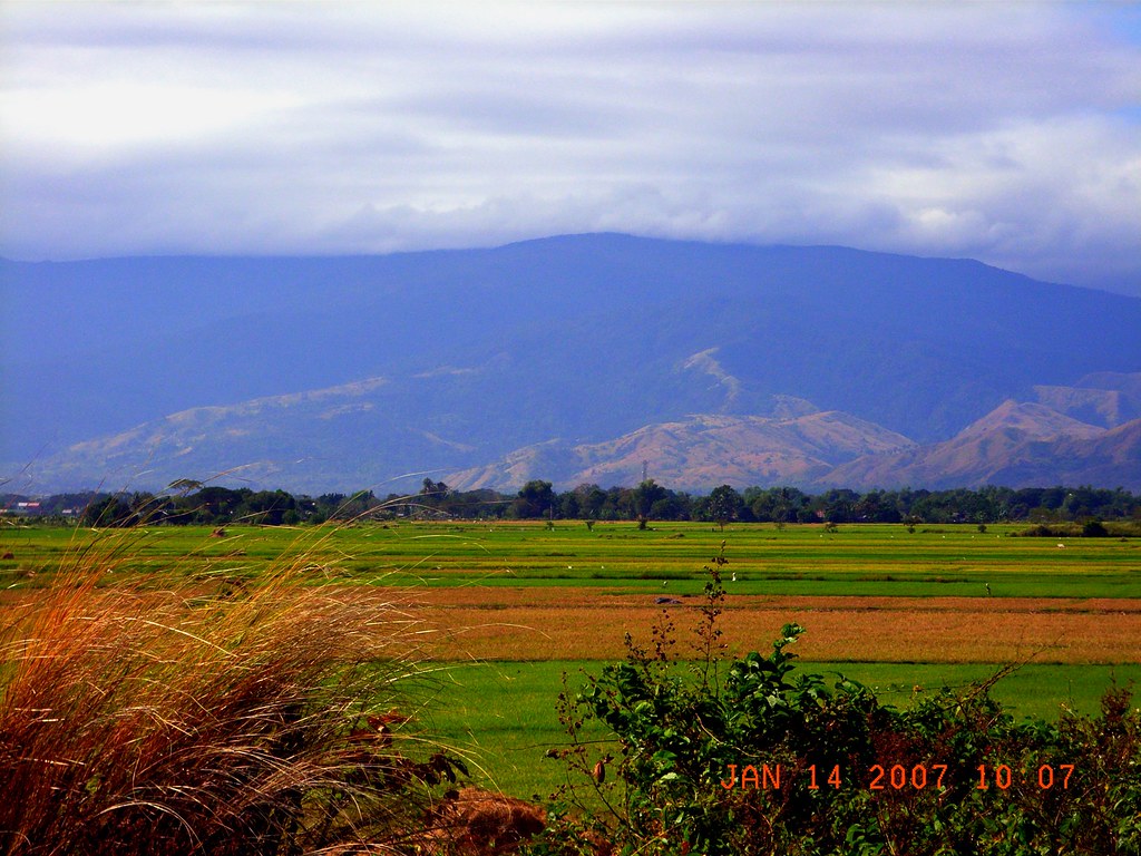
The terrain of the province, as part of the Central Luzon plains, is typically flat, with a few parts being hilly and/or mountainous. The northeastern municipalities of San Manuel, San Nicolas, Natividad, San Quintin and Umingan have hilly to mountainous areas, situated at the tip of the Cordillera mountains. The Zambales mountains extend to the province's western towns of Labrador, Mabini, Bugallon, Aguilar, Mangatarem, Dasol, and Infanta forming the mountainous portions of those towns.
The Philippine Institute of Volcanology and Seismology (PHIVOLCS) reported several inactive volcanoes in the province: Amorong, Balungao, Cabaluyan, Cahelietan, Candong, and Malabobo. PHIVOLCS reported no active or potentially active volcanoes in Pangasinan. A caldera-like landform is located between the towns of Malasiqui and Villasis with a center at about 15° 55′ N and 120° 30′ E near the Cabaruan Hills.
Several rivers traverse the province. The longest is the Agno River, which originates from the Cordillera Mountains of Benguet, eventually emptying its waters into the Lingayen Gulf. Other major rivers include the Bued River, Angalacan River, Sinocalan River, Patalan River and the Cayanga River.The province of Pangasinan is subdivided into 44 municipalities, 4 cities, and 1,364 barangay (which means "village" or "community"). There are six congressional districts in the province.
The capital of the province is Lingayen. In ancient times, the capital of Pangasinan was Binalatongan, now San Carlos City.Pangasinan has 1,364 barangays comprising its 44 municipalities and 4 cities, ranking the province at 3rd with the most number of barangays in a Philippine province, only behind the Visayan provinces of Leyte and Iloilo.
The most populous barangay in the province is Bonuan Gueset in Dagupan City, with a population of 22,042 in 2010. If cities are excluded, Poblacion in the municipality of Lingayen has the highest population at 12,642. Iton in Bayambang has the lowest with only 99 in the census of 2010.The population of Pangasinan in the 2015 census was 2,956,726 people,[3] with a density of 540 inhabitants per square kilometre or 1,400 inhabitants per square mile.
The Pangasinan people (Totoon Pangasinan) are called Pangasinan or the Hispanicized name Pangasinense, or simply taga-Pangasinan, which means "from Pangasinan". Pangasinan people were known as traders, businesspeople, farmers and fishers. Pangasinan is the third most-populated province in the Philippines. The estimated population of the indigenous speakers of the Pangasinan language in the province of Pangasinan is almost 2 million and is projected to double in about 30 years. According to the 2000 census, 47 percent of the population are native Pangasinan and 44 percent are Ilocano settlers. Indigenous Sambal people predominate in the westernmost municipalities of Bolinao and Anda. The Pangasinan people are closely related to the Austronesian-speaking peoples of the other parts of the Philippines, as well as Indonesia and Malaysia.The Pangasinan language is an agglutinative language. It belongs to the Malayo-Polynesian languages branch of the Austronesian language family and is the primary language of the province of Pangasinan, as well as northern Tarlac and southwestern La Union. The Pangasinan language is similar to the other Malayo-Polynesian languages of the Philippines, as well as Indonesia and Malaysia. It is closely related to the Ibaloi language spoken in the neighboring province of Benguet, located northwest of Pangasinan. The Pangasinan language along with Ibaloi are classified under the Pangasinic group of languages.
Aside from their native language, some educated Pangasinans are highly proficient in Ilocano, English and Filipino. Pangasinan is mostly spoken in the central part of the province in the 2nd, 3rd, 4th, and is the second language in other parts of Pangasinan. Ilocano is widely spoken in the westernmost and easternmost parts of Pangasinan in the 1st, 5th and 6th districts, and is the second language in other parts of Pangasinan. Ilocanos and Pangasinans speak Ilocano with a Pangasinan accent, as descendants of Ilocanos from first generation who lived within Pangasinan population learned Pangasinan language. Bolinao, a Sambalic language is widely spoken in the western tip of the province in the towns of Bolinao and Anda.The religion of the people of Pangasinan is predominantly Christianity with Roman Catholicism as the overwhelming majority at 80% affiliation in the population. The second major denomination in the province is the Aglipayan Church with at least 15% of the population. Other religious denominations are divided with other Christian groups such as Members Church of God International, Iglesia Ni Cristo, Baptist, Methodist, The Church of Jesus Christ of Latter-Day Saints (Mormon), Jehovah's Witnesses and Seventh-day Adventist. Few are strict believers and continue to practice their indigenous anito beliefs and rituals, like most of the people of the Philippines.
Spanish and American missionaries introduced Christianity to Pangasinan. Prior to the Spanish conquest in 1571, the predominant religion of the people of Pangasinan was similar to the indigenous religion of the highland Igorot or the inhabitants of the Cordillera Administrative Region on the island of Luzon, who mostly retained their indigenous culture and religion. A translation of the New Testament (excluding Revelation) in the Pangasinan language by Fr. Nicolas Manrique Alonzo Lallave, a Spanish Dominican friar assigned in Urdaneta, was the first ever translation of a complete portion of the Bible in a Philippine language. Pangasinan was also influenced by Hinduism, Buddhism and Islam to a lesser extent, before the introduction of Christianity. Some Pangasinense people have reverted to their indigenous religion headed by their supreme deity, Ama Kaoley or Ama-Gaolay,[11] while some Sambal people of the west have also reverted to their indigenous religion, headed by the supreme god, Malayari.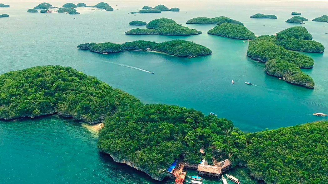
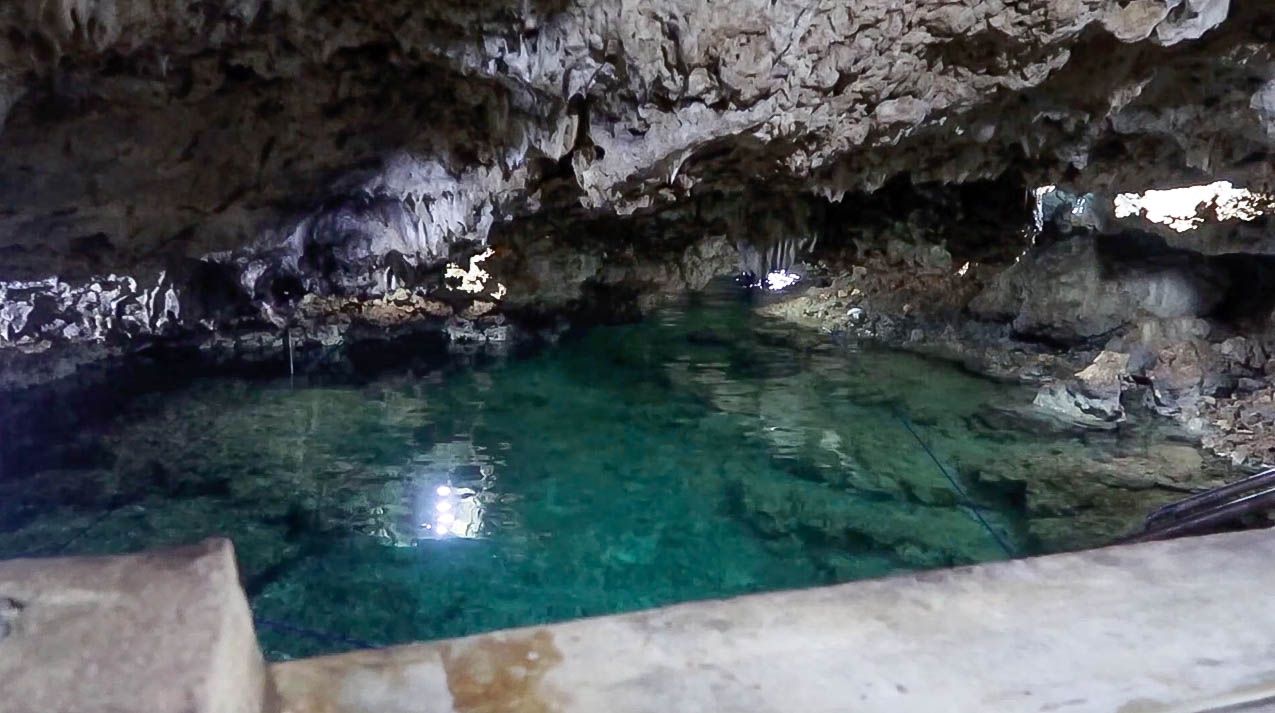
Enchanted Cave is one of the must-visit attractions in Bolinao, Pangasinan. The name itself portrays about its mystical beauty. The entire place is really enchanted since it is like a huge coral reef that emerged from underwater. Local people and tour guides believes that millions of years ago Bolinao was under the sea due to the discovery of coral rocks (limestones) and fossilized giant clams around the area.
The water inside the cave is clear and not salty. Its depth is estimated to be around 3 ft to 6 ft. There are certain areas inside the caves where the cave management authorities will restrict you to enter for safety.
Enchanted Cave offers underground pool with crystal clear spring water, natural sea rock hill terrain retouch with a kiddie pool and a white lady figurine, natural sea rocks in their natural forms as discovered, mini forest with hammocks under the trees, enchanted cave’s miniature village, cabanas which are readily equipped with electricity, public CR, and sari-sari store(convenience store).
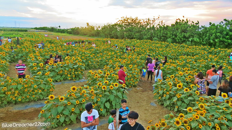
The country’s first sunflower maze is beginning to take shape in this agricultural town in Pangasinan province.
Seen from above, the giant maze of flowers would look like a fully opened sunflower sprawling at a 2,100-square-meter portion of a 3-hectare demonstration farm in Barangay C. Lichauco here.
The farm is owned by the Allied Botanical Corp. (ABC), a vegetable seed breeder, producer and distributor.
The maze, designed by landscape artist Toni Rivera, will be the main attraction of the company’s open days, As much as 8,000 sunflower plants would make up the maze. With pathways wide enough to fit four people walking side by side, Caballes said the maze can accommodate up to 100 people per tour. It will take at least 30 minutes to complete a tour of the maze.


 |
 |
 |
 |
 |
 |
 |
 |